Vacation 2012
10 July - 9 August
a tour of places in eastern USA

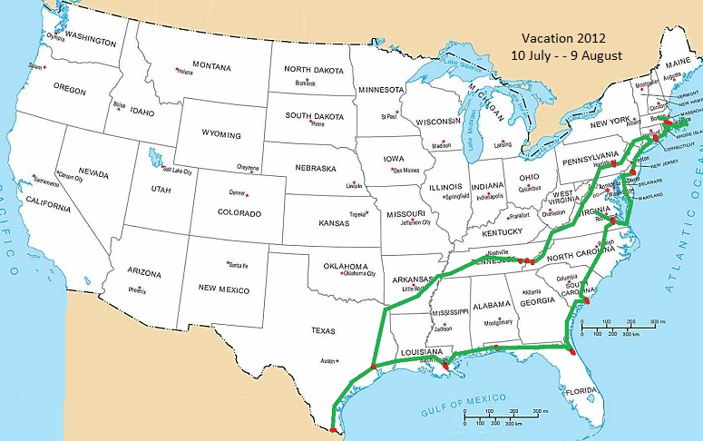
the R-pod travel trailer - - - - - - - - - - - - - - - - - - - - - - - - - - - a map of our travels
Page 7
Saturday, 21 July 2012
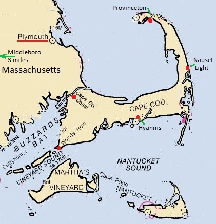
~ Cape Cod ~
visiting Cape Cod Canal - Woods Hole - Hyannis Museum -Nauset Lighthouse and beach - Provincetown and the Pilgrim Monument
~ ~ ~
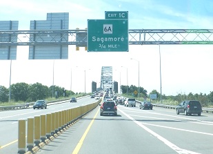
We got a late start and drove southeast crossing the Hwy 6 bridge (Sagamore Bridge) over the Cape Cod Canal.
Then followed Sandwich Rd (Hwy 6A) and turned out at one of the turnouts positioned to allow watching the traffic in the canal.
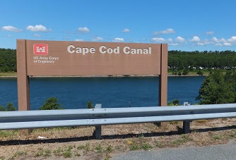
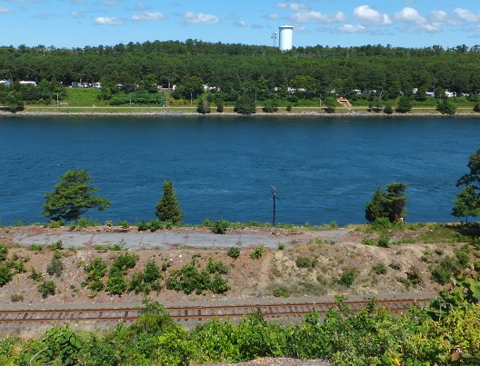
There was a strong current coming from the left going to the right.
You can see the ruffled water where there were eddies near the bank on the right side of the bigger picture.
The canal was first opened in 1914 and has been enlarged 2 times since. It affords maritime traffic from
the New York area a safe shortcut to get to Boston and points north.
From the turnout we continued on to the South attempting to find Woods Hole,
where the Oceanographic Institute is centered, and where there is a small museum.
The tiny narrow lanes are intricate and interwoven. After several false turns we finally located Woods Hole.
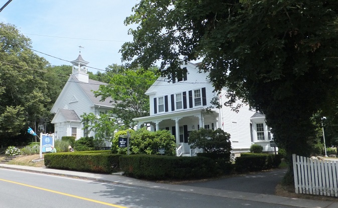
The museum is the little building with the cupola on top. Exhibits are on 2 floors.
They have exhibits of the discovery of the Titanic on Atlantic seafloor,
other undersea finds and a museum shop on the first floor.
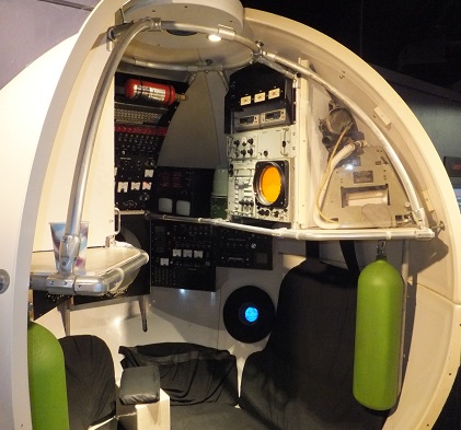
On the floor below there are some scientific exhibits including a cutaway of the
pressure chamber of the Alvin .
The guy at the museum store explained that since this was Saturday there was more parking available
and that during the week with all the scientists at work parking was very tight in Woods Hole.
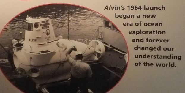
Deep submersible Alvin
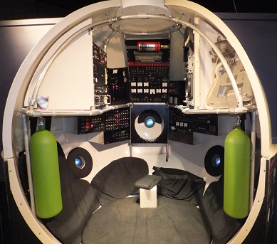
inside the pressure vessel part of Alvin where the controls are located
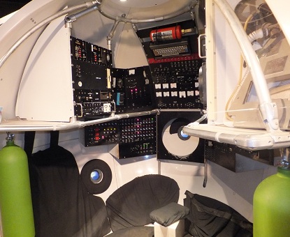 -
- 
inside Alvin to the left - - - - and - - to the right
note the very small portholes to look out - Must be very small and thick to handle the pressure at depth
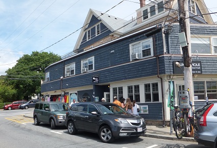
Out of the museum Joseph and I headed into town. There were a number of high priced eateries,
some quirky. There were a number of boats and ships in the little harbor.
Some of the scientific buildings were farther west, but we did not go there.
 -
- 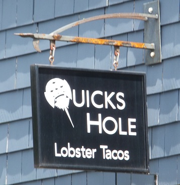
Hmmm Lobster Tacos, what an idea. But the sign shows a picture of a horseshoe crab.
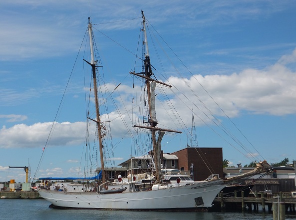
Research vessel Corwith Cramer uses a very special square rig which pulls sail out on the yard from the middle near the mast.
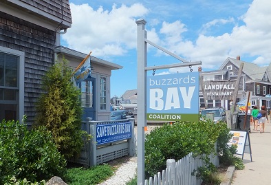
The office of the Buzzards Bay Coalition - an anti-pollution organization - had frontage on the harbor and was open.
These folks are fairly knowledgeable and serious about their efforts.
From Woods Hole we drove east and had lunch at a small neighborhood roadside restaurant,
then proceeded on to Hyannis where found the Cape Cod Maritime Museum.
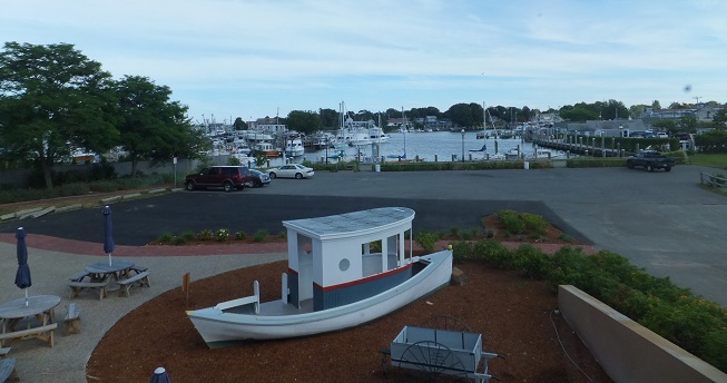
View of Hyannis harbor as seen from the west side of the museum.
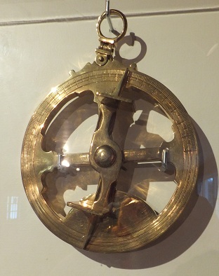
They had a good sample collection of navigagtional instruments
 - - -
- - - 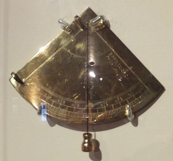
marine Astrolabe - Quadrant
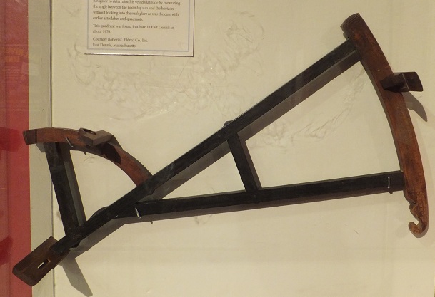
a Davis Backstaff invented by John Davis in 1591.
It allowed the navigator to get a sight of the Sun (mostly a noon sight)
by facing away from the sun and sighting the shadow against the horizon through the slot at the end away from the curved part.
This way the navigator would not have to look into the sun, as one would if using a cross-staff.
This one was found in a barn on Cape Cod.
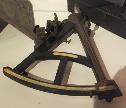
A quadrant (reflecting variety) the immediate predecessor of the modern sextant.
This instrument made it easy to sight not only the Sun, but also stars or the moon.
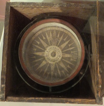
C.W. Sherman Co. New Bedford - dry card compass
mounted gimboled in a wooden box
 -
-  -
- 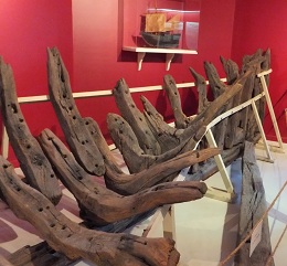
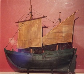
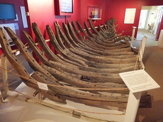
Model and actual timbers from the Sparrow Hawk a small trans-Atlantic merchant ship from the 1700s
which was mentioned in an account written by Governor William Bradford of Plymouth Colony.
 -
-  -
- 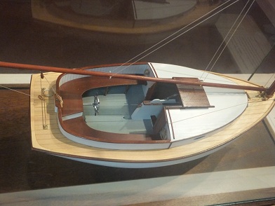
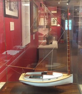
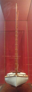
Crosby Cape Cod Catboat model from various angles. A good boat for a shallow bay.
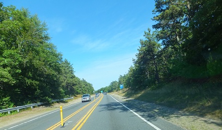
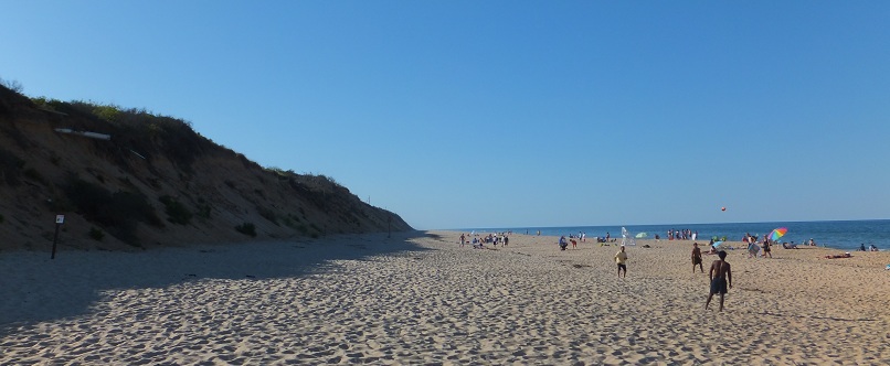
The sides of the roads on Cape Cod are thickly wooded.
While driving one can not see much of area beyond the roadway.
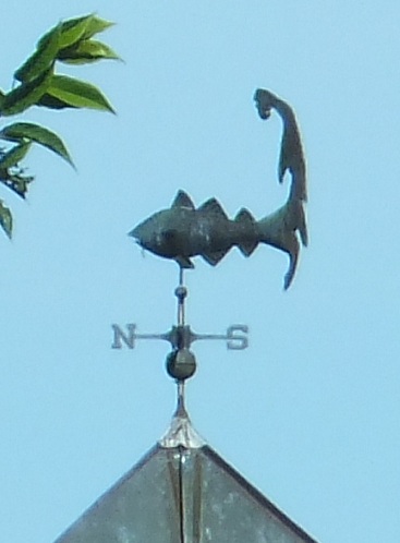
Windvane - codfish with Cape Cod outline tail
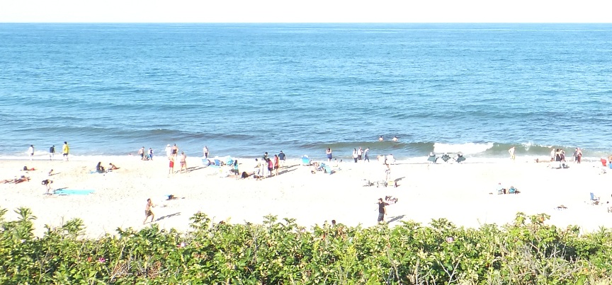
Nauset beach access - Atlantic Ocean
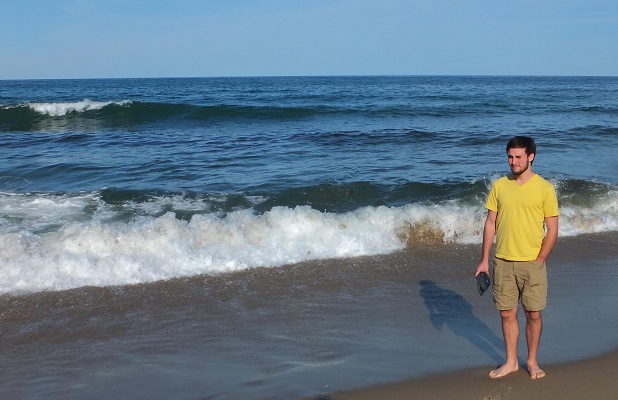
Joseph encountering the Atlantic Ocean - near the Nauset Massachusetts lighthouse
The rise behind the beach is much more significant here than on Padre Island in Texas.
 - - -
- - - 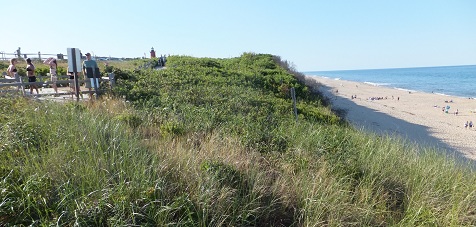
Note size of person on beach for scale and amount of rise
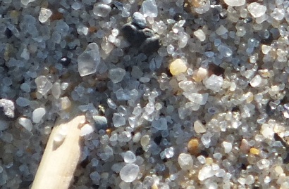
The sand is much coarser than S. Padre Is.
 - -
- - 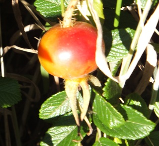
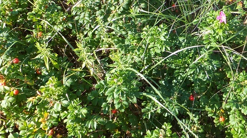
Some of the foliage on top included wild roses, some fully fruited out in glorious rose hips.
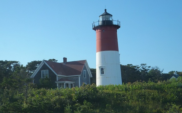
The Nauset lighthouse. Originally there were 3 lights close together.
Eventually they were reduced to 1 light and that one had to be moved inland as the Atlantic ate away at the beach.
From Nauset we traveled to Provinceton at the tip of Cape Cod.
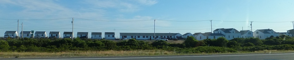
Some salt box type cottages on beach on the west side of Cape Cod, just south of Provinceton.
Our intention was to visit and climb the Pilgrim Monument.
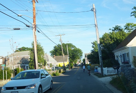
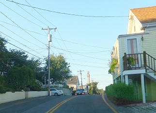
The streets of Provinceton are narrow and congested. There was a fraternity fundraising party
going on in town adding to the traffic congestion.
 -
- 
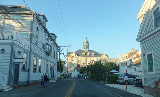
When we got to the Pilgrim Monument parking lot - on top of the hill and after we paid for parking
We walked to the tower and museum only to find that it closed in 5 minutes.
We did not pay for entrance to the museum. The tower was aldready closed.
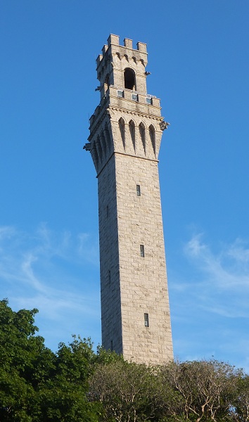
Pilgrim Monument in Provinceton, MA near the North end of Cape Cod
It is 252 ft tall (77 meters). Construction began in 1907 and was completed in 1910.
We drove to the end of the road - the north end of town.
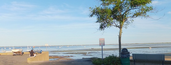
It appears that the tide was out.
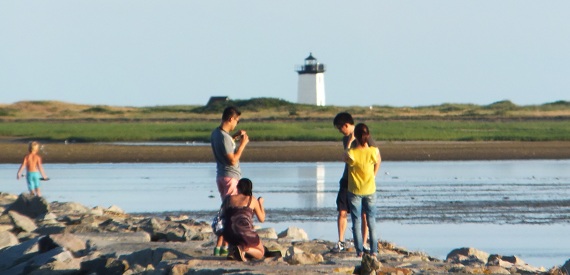
The Wood End Light was built in 1872 near the tip of Cape Cod, just out of Provinceton to the Northwest.
It is only 39 feet tall.
- - - - - - - -
From Provinceton we headed back the length of Cape Cod to our KOA camp in Middleboro.
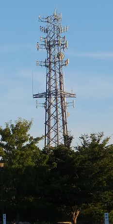
Cape Cod has a number of very robust cell phone towers.
This one seen in the early evening as we were driving about half way down Cape Cod.
~ ~ ~ ~ ~
Next - page 8 - - - Plymouth - Mayflower - Plimouth Plantation
Vacation 2012 Index page.
Vacation Index file
update 12 October 2012
Return to STexBoat Index page.