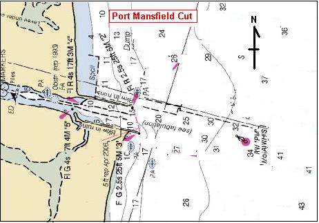
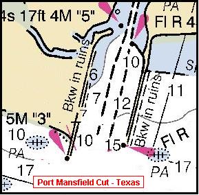
Port Mansfield Cut - on South Padre Island
in South Texas
at
26 deg. 33 min. 43 sec. North Latitude
97 deg. 16 min. 13 sec. West Longitude
23 February 2008
For several years the channel from Port Mansfield, Texas to the Gulf of Mexico has been silting up.
There was one point just outside the port itself where the channel that connects the port to the Intercoastal Waterway had a shallow spot.
This was dredged in 2007.
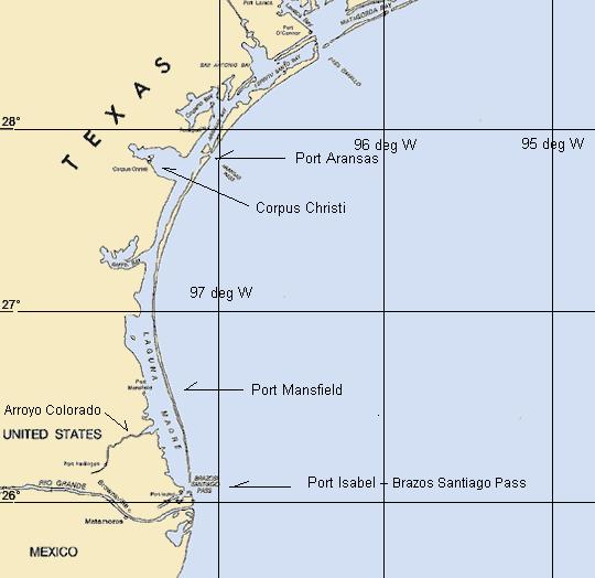 General locator map
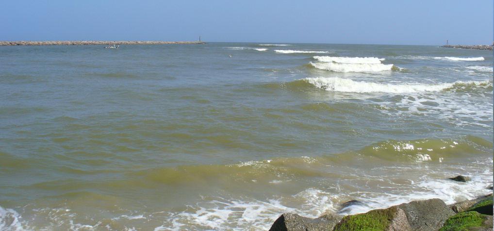
The other major silting was at the cut in South Padre Island, where there are major jetties built in the 1950s
to channel the tidal flow and attempt to keep the channel open from the Laguna Madre to the Gulf of Mexico.
This cut was reported to be seriously shoaling and boats of any size can no longer safely pass from
the Gulf of Mexico through this cut to the Laguna Madre, and on to Port Mansfield.
I had not been at this cut for over 10 years and wanted to see for myself. - February 23, 2008
Updated charts of this entrance (as evidanced by downloadable images from MapQuest) show a notation that the southern jetty is in ruins.
(Top of map segment is West.)
This is not true. The jetties themselves, made of large blocks of granite are in perfect order.
The lights at the eastern edges of the jetties exist and are working.
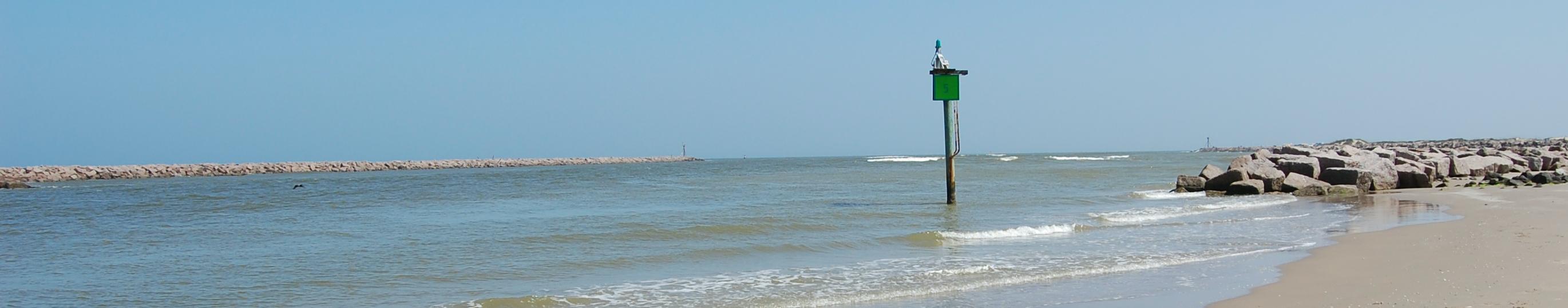
The sea bouy exists.
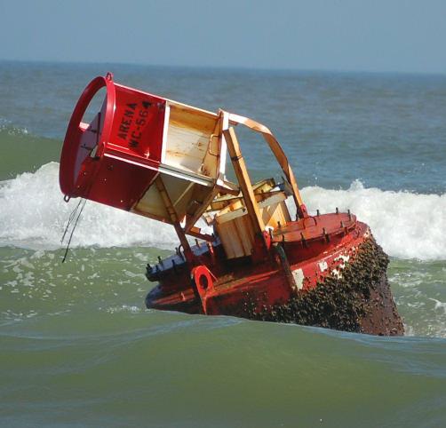
The bouy farther in (between the seabouy and the outer ends of the jetties) is not in place.
It came adrift and is in very shallow water, and is almost beached about 200 yards south of the south jetty.
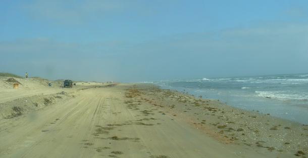
South Padre Island beach, some miles North from the town of S. Padre Island.
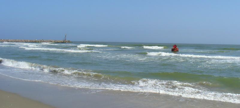
The stray bouy and the end of the south jetty at Pt. Mansfield cut.
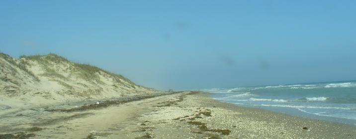
An area of high dune near the foreshore - making the drivable beach narrow.
About 2/3 of the way from Beach Access no.6 and Mansfield cut.
It is about 34 miles from Beach Access no.6 and the Mansfield cut.
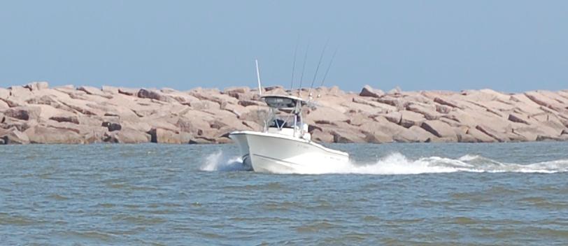
Looking East from the western (inside) end of the breakwater. You can see the Gulf ends of both breakwaters.
Note the breaking waves showing shallow water in the middle and more southern part. (right)
A local fisherman noted that there is a deeper channel closer to the Northern jetty (left side in this picture)
which he estimates to be at least 4 feet deep.
I noted several larger outboard powered boats entering which hugged the northern jetty,
and managed to enter without incident.
This picture was taken shortly after high tide.
Tidal variation is generally about 2 feet here.
Looking East from inside the end of the south jetty. North jetty on the left.
Incoming fisherman hugging the North side.
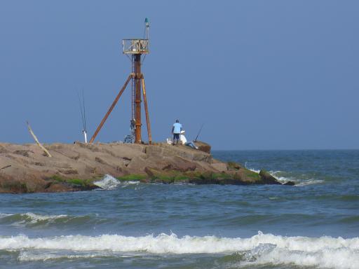
East (Gulf) end of South Jetty.
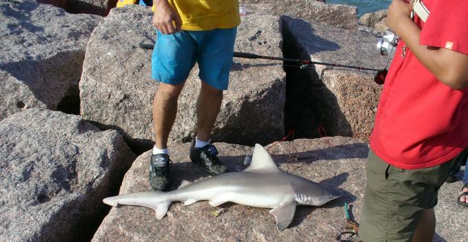
A small shark (4 ft. long exactly) caught from the S. jetty.
It was successfully released a few minutes later, swimming off from being re-launched from the beach.
-
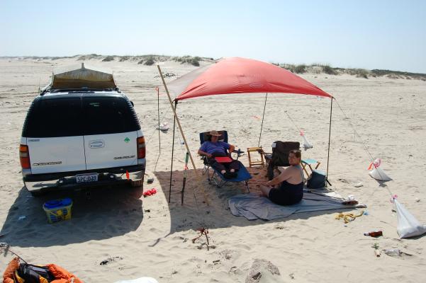
Our day camp. There were some dozen other vehicles at this location.
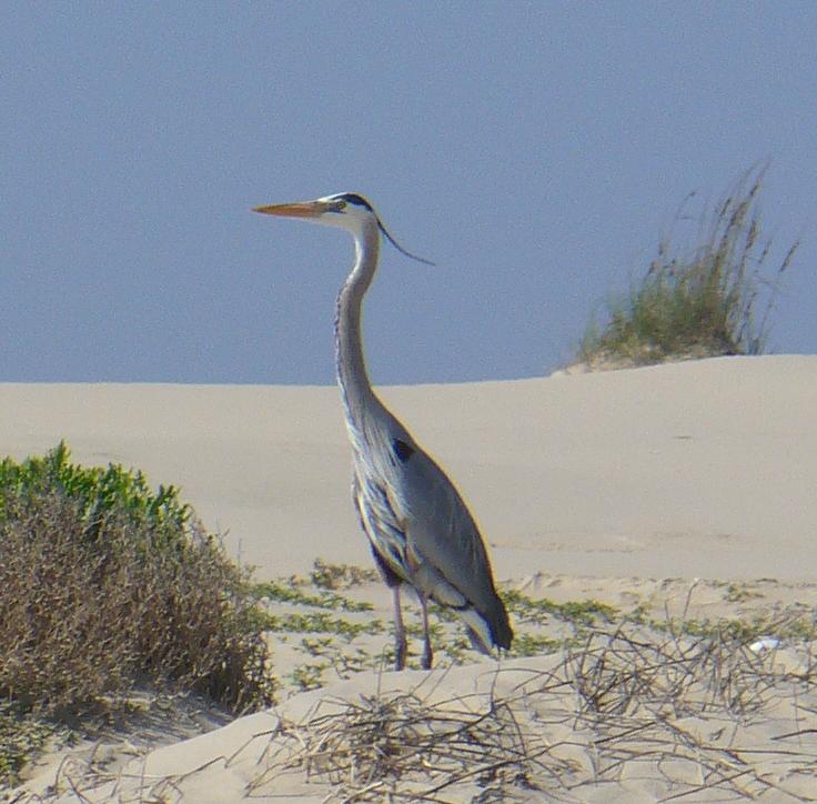
A Great Blue Heron - in the dunes.
-
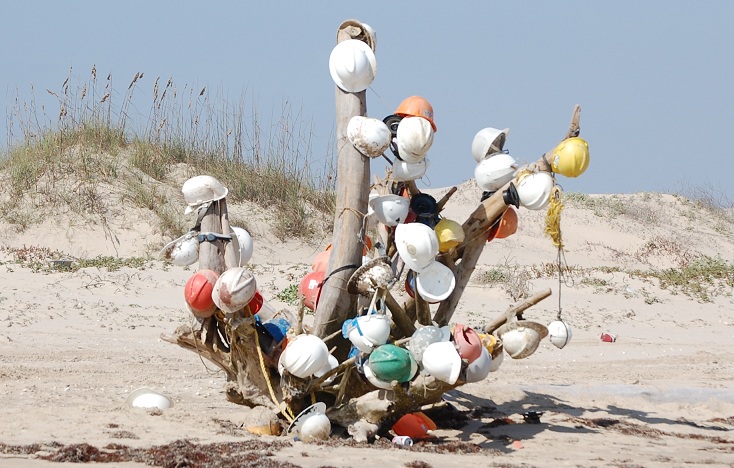
Some miles North of the Beach Access road and South of the cut there is a tree
festuned with hardhats which had washed up on the beach. - very festive.
~ ~ ~ ~ ~ ~ ~ ~ ~ ~ ~ ~ ~ ~ ~ ~ ~ ~ ~ ~ ~ ~ ~ ~
We headed back just after sunset, and nearer to high tide.
There was enough beach (firm sand) for us to make the trip without incident.